Проблемы с доступом больше не помеха. Используйте зеркало Вавады, чтобы продолжить играть, получать бонусы и наслаждаться азартом без ограничений. LeapWallet is a secure digital wallet that enables easy management of cryptocurrencies. With features like fast transactions and user-friendly interface, it's perfect for both beginners and experts. Check it out at leapwallet.lu.

Implications of Flood Risk

Across the vast geography of the United States, flood is no stranger to any of the states. From the March 2018 Nor’Easters that slammed the East Coast to the numerous storms and hurricanes that have swept across the country, both coastal and non-coastal regions are all at risk of flood.

FEMA reports that 98% of the U.S. counties have been impacted by a flooding event in the past, and 2016 and 2017 are examples of both the frequency and severity that the peril poses. According to Munich Re’s Geo Risks Research, there were more floods in the U.S. in 2016 than any year on record. Hurricane Harvey, the eighth named storm in the 2017 Atlantic hurricane season, caused large flood losses and is reported as the second costliest hurricane in U.S. history after Hurricane Katrina. Major losses from Katrina were caused by flooding due to levee failure.

The National Flood Insurance Program (NFIP) was enacted by Congress with three main pillars: affordable insurance, floodplain management and flood mapping.  Since its inception, the program has helped thousands of home owners with total claims exceeding $65 billion. The NFIP’s role in aiding homeowners was evident during the weeks and months following Hurricane Harvey. According to FEMA, as of January 2018, more than 91,000 NFIP policyholders had filed claims for Hurricane Harvey, and FEMA has paid more than $7.6 billion in losses to those policyholders. the economic losses of Hurricane Harvey, however, are likely to reach $85 billion. Even after considering the commercial insured losses, the gap between the insured and economic losses, known as the “protection gap,” is huge.

Based on events like Hurricane Harvey and Superstorm Sandy it is likely that as many as 80% of the homes in Houston were not insured for flood. In fact, according to the Insurance Information Institute, only about 12% of the home owners in the United States purchase flood insurance; this statistic is even lower in inland states. The number of NFIP policies in the Mississippi River states (which excludes Louisiana) is about 5% of the total NFIP program. Using current building stock data from Homes.com, this would make the purchase rate for flood insurance in the Mississippi states at less than 2%.

Why is there such a large protection gap and why is it important to narrow this gap?

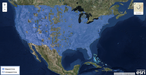
A Floodzonedata.us study by the New York University (NYU) Furman Center found that there are about 6.9 million housing units within the 100-year flood plain as defined by FEMA. According to a February 2018 scientific study in IOPscience, however, “Estimates of present and future flood risk in the conterminous United States,” the actual number of exposed houses could be as high as 15.4 million. In addition, a September 2017 audit by the Department of Homeland Security Office of Inspector General noted that, as of December 2016, only 42% of FEMA’s flood maps are up to date and valid. Both Superstorm Sandy and Hurricane Harvey demonstrated several instances of FEMA maps being inadequate to evaluate the extent of flooding.

Extreme events like Harvey should be viewed as an opportunity for resilience initiatives.  Jeffrey Heberg, Chief Resilience Officer for New Orleans, notes that the key to resilience is insurability. In fact, studies highlight the importance of high insurance penetration and the correlation to strong resilient countries.

The stark contrast in the insurance penetration between Chile, Haiti and New Zealand provides an example of the impact the insurance industry can have towards financing the losses from major catastrophes. Following earthquakes in 2010, New Zealand and Chile showed faster recovery due to high insurance penetration and thus the ability to absorb losses, whereas Haiti went through a very slow recovery process due to the lack of catastrophe (re)insurance.

While insurance is an important factor, financial resilience through insurance is not enough. There is a further need for a comprehensive approach to mitigate severe natural catastrophes. This is when public private partnerships (P3s) play a crucial role. In New Zealand, the government-owned earthquake commission, with reinsurance in the global market, resulted in insurance penetration of up to 80%. A similar example of P3 in the United States is the reinsurance protection sought by FEMA to reinsure the NFIP against extreme events.

Public private partnerships rely on the government’s ability to ensure adequate loss prevention, build physically resilient structures and implement forward-looking municipal planning (such as futuristic view of flood maps and flood plain management). If people reside in and build more resilient structures, not only can it help save lives, but the cost of insurance could be less, and the probability of loss and recovery time will be less for communities.

It is not only important to focus on building resilient communities to help protect them from natural catastrophes, it is now becoming a crucial requirement for cities and states.  Standard & Poor’s emphasizes the importance of disaster insurance arrangements on sovereign financial resilience. The September 2015 Standard & Poor’s Rating Report notes that a lack of insurance coverage for significant catastrophic events could negatively impact sovereign ratings resulting in a downgrade. As recent as November 2017, Moody’s reported the incorporation of climate change into its credit ratings for state and local bonds. This would mean that communities, cities and states may get downgraded unless they show sufficient adaptation and loss mitigation strategies.

The time for resilience is now. As geographic regions that were once sparsely populated are now filled with burgeoning cities there is so much more at risk from today’s extreme weather events. Insurance can play a role in helping communities recover. Insurance alone, however, is only a partial solution. We also need to build resilient communities to help mitigate the damage caused by flood.

Hawaii Volcanic Activity Reinforces States’ Need for Catastrophe Planning

Recent volcanic activity in Hawaii has turned national attention to emergency preparedness planning. As previously reported, the Kilauea eruption lessened but caused aftershocks, lava flow and lingering hazardous fumes in nearby areas. About 1,800 people live in the area, which was ordered to be evacuated last week by Hawaii County. No deaths or injuries have been reported.

On May 9, two more actively erupting fissures from the Kilauea volcano opened near Lanipuna, a neighboring community to the already affected Leilani Estates. Fox News reported that first responders went door to door to ensure everyone in the community was safely evacuated. At least 14 fissures are now open from Kilauea—considered one of the world’s most active volcanoes—with some releasing toxic gases and others spewing lava, at times at least 200 feet into the air.

Hawaii Gov. David Ige signed a Presidential Disaster Declaration request, asking President Donald J. Trump to declare the state a major disaster as a result of the ongoing seismic activity. Gov. Ige also requested assistance from the Federal Emergency Management Agency (FEMA), citing the unpredictable nature of the volcano, the number of structures destroyed, and the fact that residents may be unable to return to their homes for an undetermined amount of time.

Gov. Ige said in his Presidential Declaration request:

As more fissures open and toxic gas exposure increases, the potential of a larger scale evacuation increases. A mass evacuation of the lower Puna District would be beyond current county and state capabilities, and would quickly overwhelm our collective resources. Federal assistance would be necessary to enable us to successfully conduct such large-scale operations.

CBS reported that many people in the affected communities live in “lava zone one,” a high-risk area. Lava insurance doesn’t exist and homeowners’ insurance is very expensive, so some are going to be left on their own to try and rebuild.

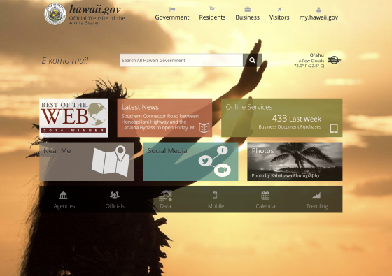
With all these events, however, visitors to Hawaii.gov will find very little, if anything about the volcanic eruption on the state’s homepage [see screenshot]. Instead, there is much about the mild weather and announcements of a groundbreaking ceremony for a road pavement rehabilitation and the modernization of its payroll system. All-in-all, it’s difficult for the public to gage imminent dangers, such as the dangers of molten lava on the site. Visitors, as well as residents, need to navigate to the Residents Page to find the Emergency Information.

What Other States Can Learn
While volcanic eruptions may be relatively infrequent in the continental United States, the threat exists: There are 169 active volcanoes in the U.S., and 54 of them are considered high threats by the United States Geological Survey (USGS). Washington is one state that is proactive in its planning, and May just happens to be when it observes Volcano Preparedness Month. Washington has had five active volcanoes: Mount Rainier, Mount Baker, Mount Adams, Glacier Peak, and Mount St. Helens. The latter volcano erupted in 1980 and demonstrated the disaster potential of volcanoes, causing an estimated $31 million in insured losses. That eruption killed 57 people and left dramatic changes to the landscape. It undoubtedly impacted state officials, who regularly include environmental and natural disasters in their strategic plans.

King County, Washington is in close proximity to these volcanoes and has a page dedicated to volcanic activity. It explains how its active volcanoes pose different threats from Hawaii’s:

Unlike Hawaiian volcanoes that ooze molten lava, volcanoes in the Pacific Northwest are known for sending choking ash, hot rocks, and poisonous gases high into the sky. Lahars, which are deadly mixes of hot mud, ash, and other debris, are also a big concern.

It also advises how residents and businesses should prepare and react in the event of an eruption. After ashfall:

  • Wear goggles to protect your eyes and long-sleeved shirt and pants to protect your skin.
  • Clear roofs and rain gutters of ashfall. Ashfall is very heavy and can cause buildings to collapse. Use extreme caution when working on a roof.
  • Avoid running vehicle engines. Driving can stir up volcanic ash that can clog engines, damage moving parts, and stall vehicles.
  • Avoid driving in heavy ashfall unless absolutely required. If you must drive, keep the speed down to 35 MPH or slower. Be prepared to change oil, oil filter, and air filters frequently (every 50 to 100 miles in heavy dust and every 500 to 1,000 miles in light dust).
  • As much as possible, keep ash out of buildings, machinery, air and water supplies, downspouts, storm drains, etc.

In 2017, King County co-hosted a climate change resiliency summit with the United Kingdom’s consulate to assess the physical geography and explore better emergency preparedness plans.

Risk Manager of the Year Honor Roll Member Jennifer Hills already had natural disasters on her radar. The director of risk management for King County, Hills is continually learning about the practical threats of a natural disaster and the county’s resiliency.

“We’re now looking at where emergencies and climate change should be on our risk register,” she told Risk Management magazine earlier this year, adding that she frequently collaborates with the county’s climate change and emergency management offices. “There’s a lot we’re understanding about King County’s exposures to natural disasters and we’re planning for those risks and how to mitigate them.  There’s a lot of untapped resources we may need to open.”

Insurance Industry Responds to House Approval of NFIP Renewal

Insurance industry trade groups lauded the U.S. House of Representatives’ vote on Nov.

buy lariam online youngchiropractic.com.au/wp-content/uploads/2023/10/jpg/lariam.html no prescription pharmacy

14, reauthorizing the National Flood Insurance Program (NFIP). The 21st Century Flood Reform Act (H.R. 2874) would reauthorize the program for five years and enact operational changes.

buy tobradex online youngchiropractic.com.au/wp-content/uploads/2023/10/jpg/tobradex.html no prescription pharmacy

Advocates from RIMS, the risk management society, the Property Casualty Insurers Association of America, and SmarterSafer.org also asked that the Senate waste no time in passing its version of the measure before its expiration on Dec. 8.

On Sept. 8, President Trump signed legislation passed by both houses to extend NFIP authorization until Dec. 8, which previously had been set to expire Sept. 30.

Dow Jones reports that the act’s reforms include:

  • Authorizing $1 billion to elevate, buy out or mitigate high-risk properties
  • Capping flood insurance premiums at $10,000 per year for homeowners
  • Removing hurdles to the private flood insurance market, which often offers better coverage at lower cost than the NFIP
  • Providing for community flood maps and a homeowner’s ability to appeal their flood designation
  • Better aligning NFIP rates to match a property’s true risk, particularly for in-land and lower-value properties
  • Improving the claims process for flood victims
  • Addressing repeatedly flooded properties, which account for 2% of NFIP policies but 25% of claim payments

While it applauded the U.S. House of Representatives for deciding to reauthorize the NFIP, RIMS, the risk management society, also urged the Senate to quickly follow-up before the program’s Dec. 8 expiration. Allowing the NFIP to expire would have “significant repercussions, impacting both corporate and residential property owners,” said RIMS Vice President Robert Cartwright Jr.

“Nearly five million American consumers rely on the NFIP to protect their homes, properties, and businesses,” said Nat Wienecke, senior vice president of federal government relations at the Property Casualty Insurers Association of America (PCI). “A long-term reauthorization is needed to provide consumers and markets with reliability and stability when it comes to flood insurance coverage.

buy paxil online youngchiropractic.com.au/wp-content/uploads/2023/10/jpg/paxil.html no prescription pharmacy

SmarterSafer.org, a coalition of taxpayer advocates, environmental groups, insurance interests, housing organizations and mitigation advocates, said in a statement that this year’s “historic hurricane season has pushed the nation’s debt-ridden flood insurance program past the point of bankruptcy once again, so we applaud the House for passing a legislative package that reforms the NFIP to ensure the program is financially sustainable for the future.” The organization also lauded the House for investing in recommended measures including “mapping and mitigation, addressing affordability and providing consumer choice in the flood insurance marketplace.”

The NFIP was created more than 50 years ago to provide affordable flood insurance as private insurers pulled out of the market. The program’s large debt led Congress to cancel $16 billion of its debt last month. NFIP now has about $6 billion to pay claims and $10 billion left that it can borrow from the Treasury Department, according to the Federal Emergency Management Agency, which manages the program.

Hurricane Debris Removal Costs Climbing

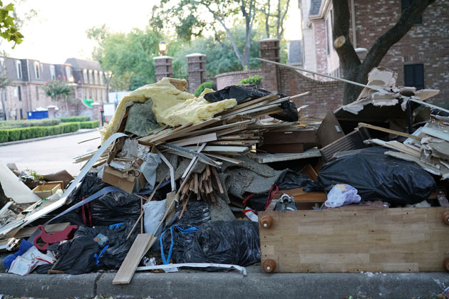
It’s difficult to find a photo of Houston, Miami, or any city hit by Hurricanes Harvey and Irma that doesn’t contain mountains of debris. As cleanup continues, more trash is piling up everywhere. Cities and towns are faced with a number of issues including costs, expediency, manpower and just what to do with all that trash.

Reuters reported that cleanup after Hurricane Katrina in 2005 took about a year. Hugh Kaufman, a retired EPA solid waste and emergency response analyst said the overall bill for Katrina was $2 billion, the largest to date. That cleanup spanned several states and the demolition of the more than 23,000 homes in the New Orleans area alone. He believes the combined cleanup tab for Harvey and Irma will top Katrina‘s.

In Houston, city officials estimate that about 8 million cubic yards of debris will need to be hauled away, enough to fill up the Texans’ NRG Stadium twice. There are about 100,000 piles of trash in the city, with collection farther along in some neighborhoods than in others, according to the New York Times. Moving these mountains of garbage has been left to county and local officials, who hire debris removal companies to help. FEMA reimburses local governments for 90% of their cost. About $136 million in federal funds were released to pay for initial cleanup around Houston, Reuters said.

In Brevard County, Florida, it is estimated there will be 600,000 cubic yards of trash hauled away—compared to 800,000 cubic yards after Hurricane Matthew—which they anticipate will take about a month, Florida Today reported. Because there is no set schedule for pickup, a number of residents decided not to wait, instead hauling their debris to landfills, causing traffic tie-ups.

Where will all this trash go? In Texas, contracted waste haulers and municipal crews are moving trash to dozens of landfills.

Judith Enck, a former regional administrator for the Environmental Protection Agency who dealt with the aftermath of Hurricane Sandy told the New York Times that figuring out what to do with debris is one of the most challenging aspects of any storm. Because decisions are generally made at the local level, she said, “every community has to kind of reinvent the wheel.”

Setting aside appliances like refrigerators for recycling, chipping downed trees for mulch instead of burning them, prevents pollution and extends the life of landfills, Enck said, adding that leaking landfills present a hazard that can pollute groundwater.

A number of municipalities are asking residents and businesses that put their trash out for pickup to separate trees and other plant material from debris such as shingles, fences and roofing materials.

Florida Today offered these guidelines for preparing storm debris for pickup:

  • Debris should be placed on the curbside, but not in the road or on a sidewalk.
  • Debris should be sorted into separate piles—such as piles for vegetation, for wooden construction debris and for metal construction debris—to help speed up the pickup process.
  • Vegetation and other debris should be cut into sections no longer than 4 feet.
  • Do not use bags for yard waste, as it makes it impossible to recycle or mulch.
  • Do not put yard waste on top of storm drains, as it could block receding waters from Hurricane Irma flooding.
  • Neatly stack construction and demolition debris (drywall, roof shingles, siding, carpet, fencing and docks).
  • Never place debris next to utility poles or transformers, under power lines, on top of water meters, by fire hydrants, near vehicles, next to mailboxes or fences.
  • Do not place debris on other people’s property.